CBS News Live
CBS News Texas: Local News, Weather & More
Watch CBS News
Breaking Local news, First Alert Weather & I-Team Reports
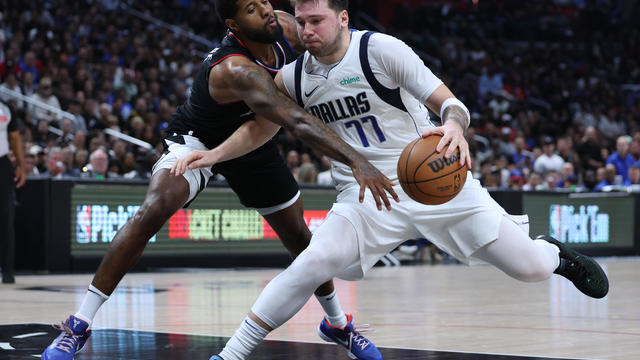
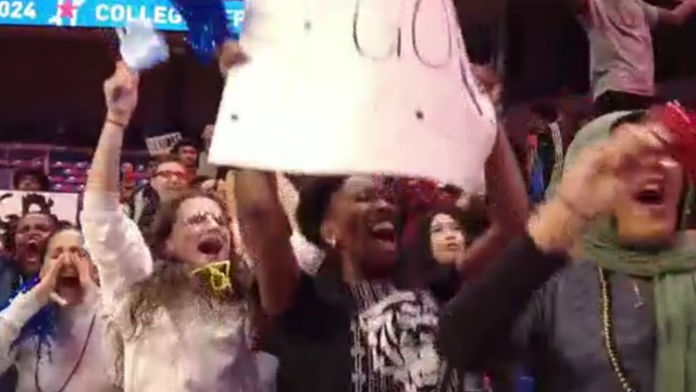
Luka Doncic scored 32 points and the Dallas Mavericks overcame the return of Clippers superstar Kawhi Leonard to beat Los Angeles 96-93 and tie their Western Conference first-round playoff series at a game apiece.
Expanded federal overtime rule could result in employers paying workers an additional $1.5 billion, according to one estimate.
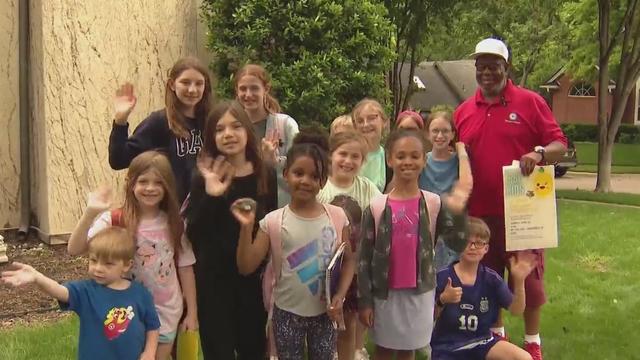
On Tuesday, School Bus Driver Appreciation Day, the kids gave their driver James Fonteno the surprise - and surprised he was!

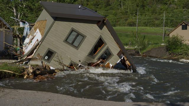
Neighbors said they knew something was amiss while watching the flames.
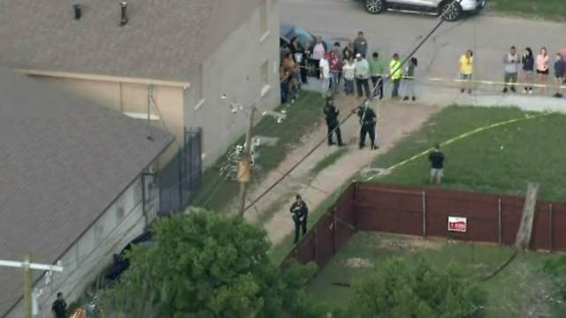
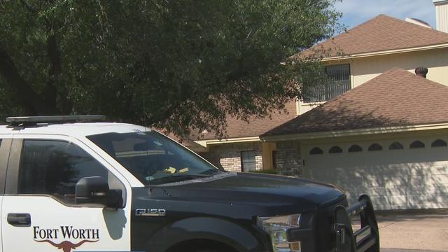
The shooting happened just after 5:30 p.m. at a home in the 2400 block of Irion Avenue near Northeast 28th Street.
Students must be accepted to college to graduate high school and start working with college counselors from a young age.
"So in three-and-a-half months, we've had five deaths," said Alisa Simmons, Tarrant County Precinct 2 commissioner. "Somebody needs to be paying attention."
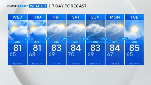
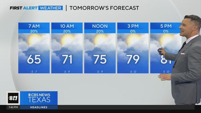
It's storm season in North Texas. CBS News Texas meteorologists are looking at the possibility of severe storms in the metroplex starting Friday afternoon.
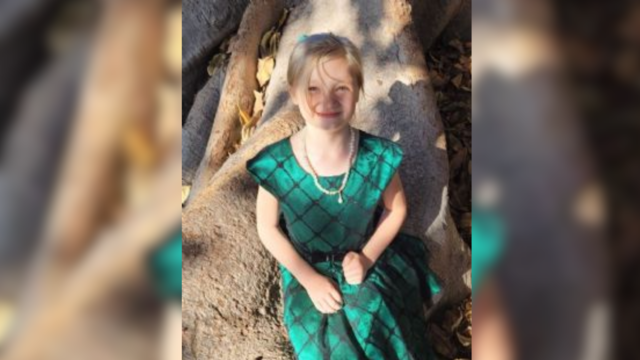
Don Steven McDougal, a family friend, was indicted by a Polk County grand jury in connection with the death of an 11-year-old girl.
CBS News Texas watched surveillance video from a triple shooting connected to a prom night after party in Fort Worth. There are at least 12 seconds of gunfire as people scatter to safety.
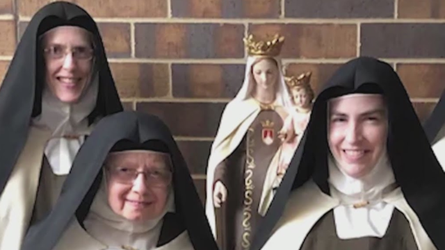
"We are not things to be traded or given away in backroom deals," the nuns wrote in a four-page response to the decree posted to their website Saturday afternoon.
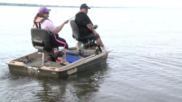
Bois D'Arc Lake is now open to families, boaters and fishers just an hour northeast of DFW in Fannin County.
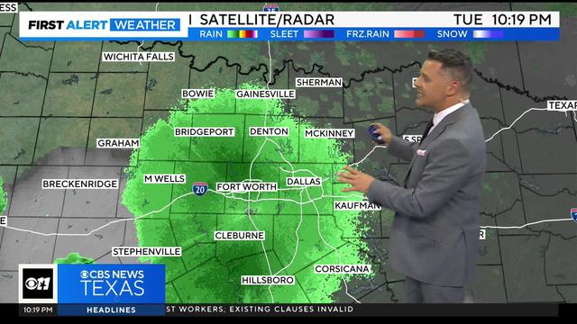
Rain chances really start to ramp up late Thursday heading into Friday.
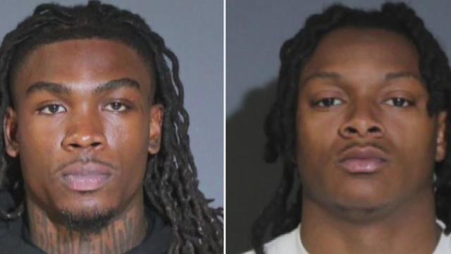
A victim in that crash is now suing Rice and Knox for $1 million. Police say they were both driving at high speeds that led to a six-car crash on the highway. Two other crash victims are suing Rice and Knox. They both face multiple felony charges.
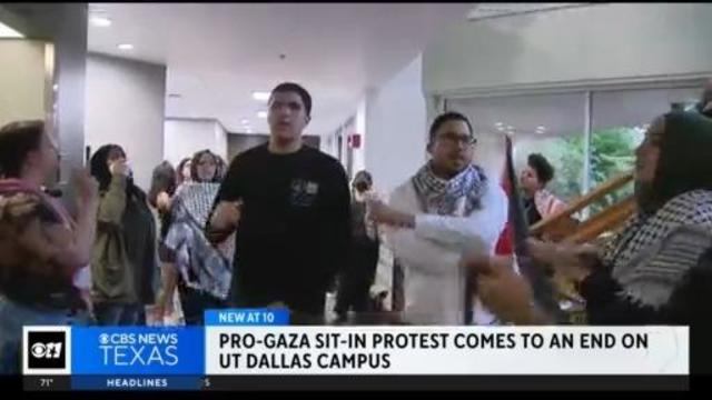
A pro-Gaza sit-in protest on the UT Dallas campus has come to an end after university administrators agreed to meet with the students.
School Bus Drivers carry our most precious cargo, and on School Bus Driver Appreciation Day, some Richardson ISD Students wanted to do something special for their driver.
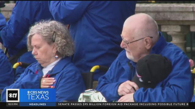
CBS News Texas anchor Doug Dunbar joined "Honor Flight DFW" in honoring veterans on an emotional trip to visit memorials in Washington D. C.
Rain chances really start to ramp up late Thursday heading into Friday.
Rain chances should remain relatively low, as the area stays capped.
It's storm season in North Texas. CBS News Texas meteorologists are looking at the possibility of severe storms in the metroplex starting Friday afternoon.
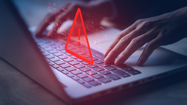
A scammer a North Texas woman met on Instagram claimed to be a German cardiologist, and for months, the two messaged back and forth, building what she thought was a true relationship.
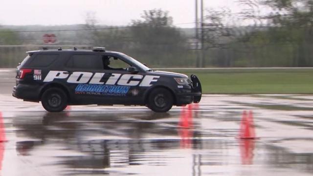
Texas police departments have the discretion to determine the frequency and extent of additional driving training for their officers. While some require driving training yearly or every other year, others do not.
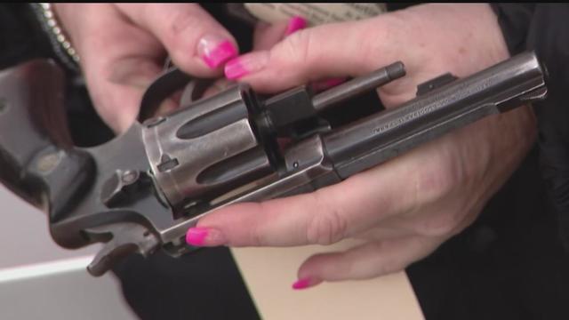
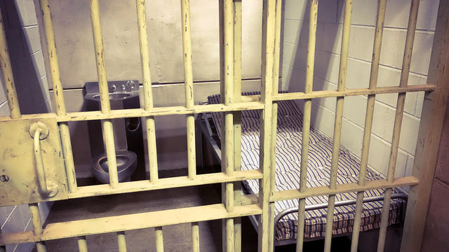
Some departments opt to melt the firearms down, while others choose to crush them. However, there are instances where firearms, or at least parts of them, escape destruction altogether.
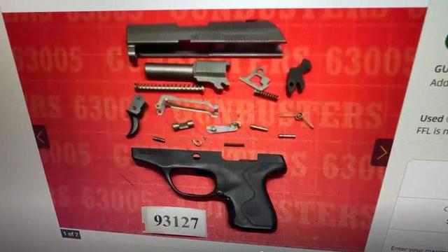
Several police departments told the CBS News Texas I-Team they were unaware of this practice, even though it was stated in the contracts they signed with the company, Gulf Coast GunBusters.
It's a complicated process that not everyone qualifies for.
Luka Doncic scored 32 points and the Dallas Mavericks overcame the return of Clippers superstar Kawhi Leonard to beat Los Angeles 96-93 and tie their Western Conference first-round playoff series at a game apiece.

The WNBA team says there's now a waitlist for season tickets.
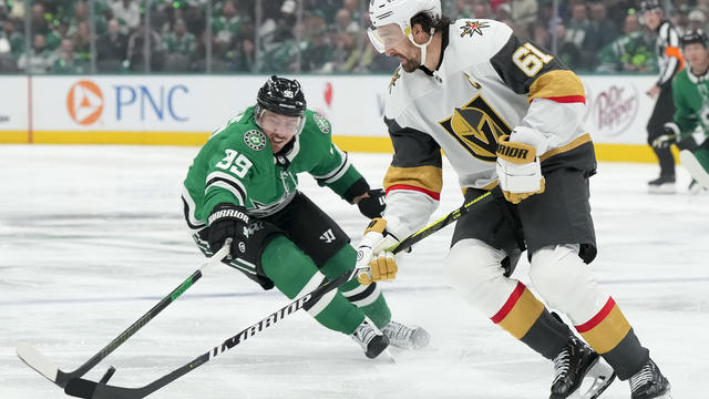
Vegas captain Mark Stone scored quickly after missing two months, Tomas Hertl had a goal in his playoff debut for the Golden Knights and the reigning Stanley Cup champions opened defense of their title with a 4-3 win over the top-seeded Dallas Stars.
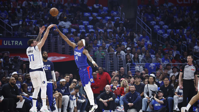
The teams were meeting in the playoffs for the third time in five years, with the Clippers having won both previous series.
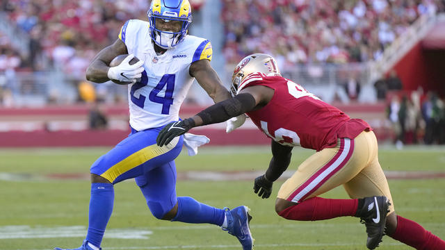
The Dallas Cowboys have signed free agent running back Royce Freeman.
Luka Doncic scored 32 points and the Dallas Mavericks overcame the return of Clippers superstar Kawhi Leonard to beat Los Angeles 96-93 and tie their Western Conference first-round playoff series at a game apiece.
Expanded federal overtime rule could result in employers paying workers an additional $1.5 billion, according to one estimate.
On Tuesday, School Bus Driver Appreciation Day, the kids gave their driver James Fonteno the surprise - and surprised he was!
Neighbors said they knew something was amiss while watching the flames.
The shooting happened just after 5:30 p.m. at a home in the 2400 block of Irion Avenue near Northeast 28th Street.
A scammer a North Texas woman met on Instagram claimed to be a German cardiologist, and for months, the two messaged back and forth, building what she thought was a true relationship.
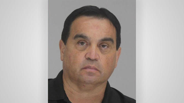
They found him guilty – now four jurors are explaining how they were convinced to convict Dr. Raynaldo Ortiz.
Texas police departments have the discretion to determine the frequency and extent of additional driving training for their officers. While some require driving training yearly or every other year, others do not.
Some departments opt to melt the firearms down, while others choose to crush them. However, there are instances where firearms, or at least parts of them, escape destruction altogether.
Several police departments told the CBS News Texas I-Team they were unaware of this practice, even though it was stated in the contracts they signed with the company, Gulf Coast GunBusters.

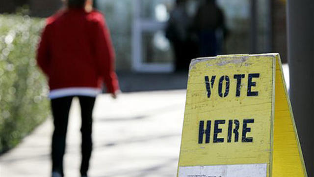
Regulators prohibit new noncompetes, which impede millions of U.S. workers from getting a better job.

Starting in September of 2024, the year-long residency will allow new teachers to work with veteran teachers before taking on their own classroom.

Senators approve foreign aid package that includes a potential ban on TikTok in the U.S. Here's what experts say could happen next.
The bond includes upgrades to city streets, parks and public safety facilities. The largest single ticket item in this year's bond includes $50 million for the newly proposed Dallas Police Department's new training facility.
People who have experienced extreme weather are especially likely to say climate change needs to be addressed right away.

Self-driving 18-wheelers have longtime truckers worried about their livelihood and others concerned that the technology needs more testing to make sure the public is safe.
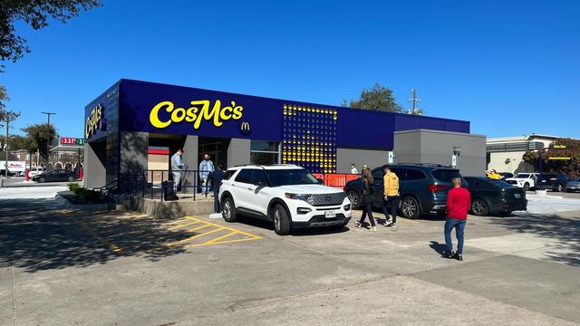
McDonald's concept restaurant CosMc's has taken its drink-focused menu to Dallas for its second-ever location.
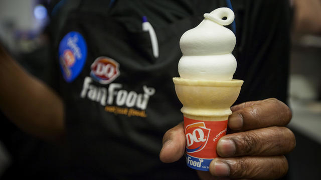
With the country on the cusp of greeting the return of spring, a warm-weather treat is once again available for free for a limited time only.

Kelli and Michael Regan were looking for a new dog. The breeder they found online asked them to pay with gift cards.
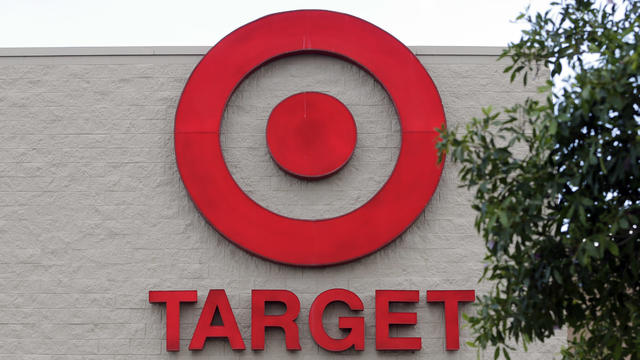
Target, looking for ways to add sales, is relaunching its Target Circle loyalty program including a new paid membership with unlimited free same-day delivery in as little as an hour for orders over $35.
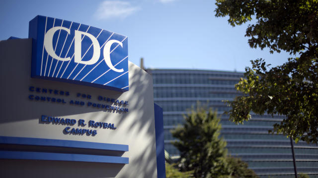
The CDC estimates the U.S. could reach 300 measles cases in 2024 — more than the recent peak two years ago.
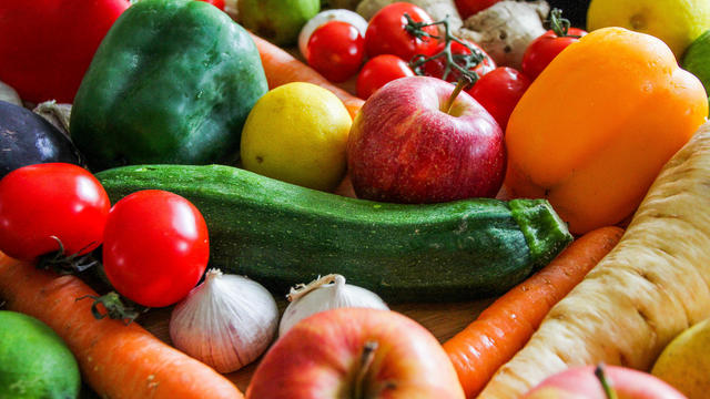
Organic option is best when buying certain produce, especially blueberries, nonprofit group says in analysis of chemical residues.

The $872 million most likely excludes any amount UnitedHealth may have paid to hackers in ransom.

More than 20 people have been stricken after getting fake or mishandled injections in homes and spas, feds warn.
George Schappell and sister Lori, of Reading, Pa., were the world's oldest conjoined twins, according to the Guinness Book of World Records.
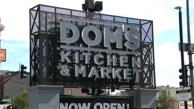
The closure affects both Dom's locations in Chicago, and all 33 Foxtrot stores in Chicago, Texas, and the Washington D.C. area.
Texas law SB 14 prohibits drug and surgical "gender transition" interventions for minors.
The projects are expected to create at least 17,000 construction jobs and 4,500 manufacturing jobs.
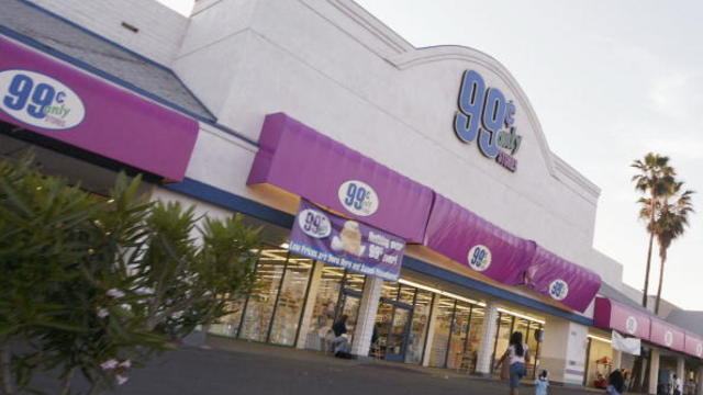
After more than 40 years in business, 99 Cents Only Stores, a discount chain, announced on Thursday that it will close all 371 of its locations and cease operations.
"This is huge, HUGE! If we don't plan appropriately, A, we won't have workers. Or B, we'll have so many people on the streets that nobody can get to the events."
Luka Doncic scored 32 points and the Dallas Mavericks overcame the return of Clippers superstar Kawhi Leonard to beat Los Angeles 96-93 and tie their Western Conference first-round playoff series at a game apiece.
The WNBA team says there's now a waitlist for season tickets.
Vegas captain Mark Stone scored quickly after missing two months, Tomas Hertl had a goal in his playoff debut for the Golden Knights and the reigning Stanley Cup champions opened defense of their title with a 4-3 win over the top-seeded Dallas Stars.
The teams were meeting in the playoffs for the third time in five years, with the Clippers having won both previous series.
The Dallas Cowboys have signed free agent running back Royce Freeman.
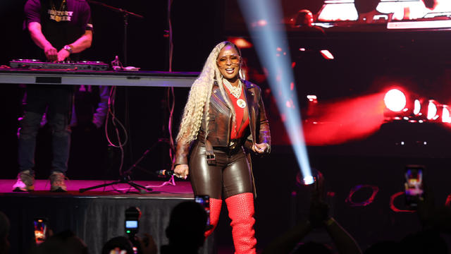
Mary J. Blige, Cher, Foreigner, A Tribe Called Quest, Kool & The Gang, Ozzy Osbourne, Dave Matthews Band and Peter Frampton have been named to the Rock & Roll Hall of Fame.

Taylor Swift broke her own records, Spotify said, and now owns the record for the top three most-streamed albums in a single day.
The singer was found deceased at her home, a representative said.
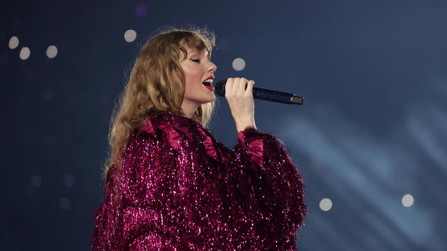
Anticipation was growing at a fever pitch before Taylor Swift's latest album, "The Tortured Poets Department," dropped at midnight EDT. But it turned out it's actually a double album.

The singers first dated in 2003 and delighted fans when they rekindled their relationship in 2023.
Rain chances really start to ramp up late Thursday heading into Friday.
A victim in that crash is now suing Rice and Knox for $1 million. Police say they were both driving at high speeds that led to a six-car crash on the highway. Two other crash victims are suing Rice and Knox. They both face multiple felony charges.
A pro-Gaza sit-in protest on the UT Dallas campus has come to an end after university administrators agreed to meet with the students.
School Bus Drivers carry our most precious cargo, and on School Bus Driver Appreciation Day, some Richardson ISD Students wanted to do something special for their driver.
CBS News Texas anchor Doug Dunbar joined "Honor Flight DFW" in honoring veterans on an emotional trip to visit memorials in Washington D. C.

Dallas artist Roberto Marquez traveled to the Rafah Crossing in Egypt, the U.S. capital and will attend this weekend's statewide protest in Austin.
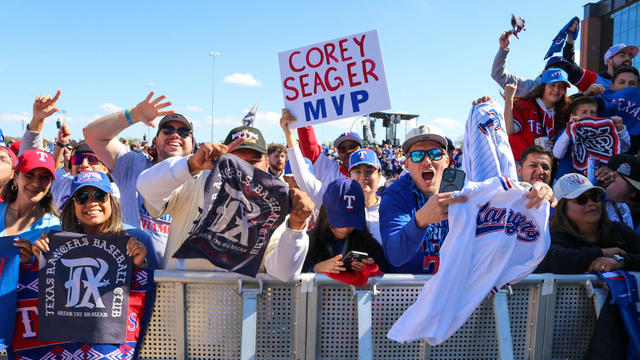
On Friday, hundreds of thousands of fans gathered outside and all around Globe Life Field in Arlington to celebrate the Texas Rangers historical World Series win!

Babies in the neonatal intensive care unit at several Texas Health hospitals were dressed in creative costumes for Halloween.
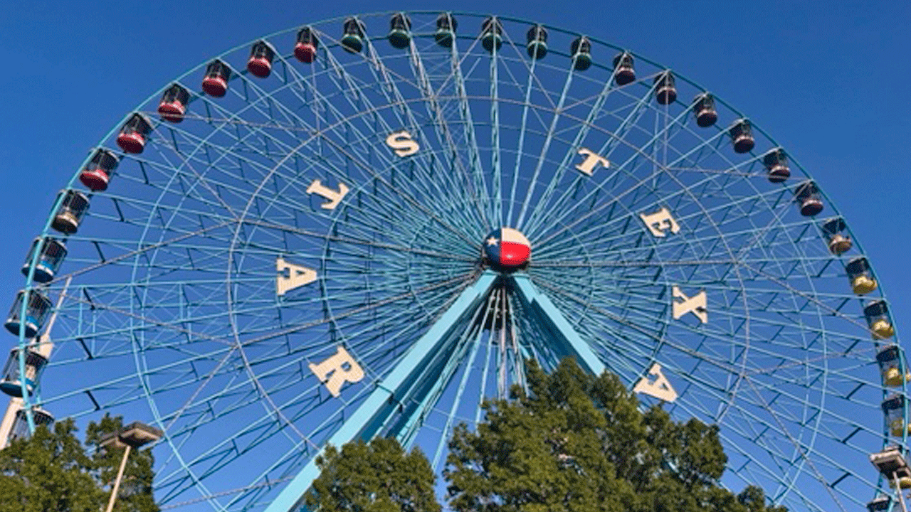
Is that the smell of cotton candy, beignets and brisket wafting over Fair Park? It sure is, and we are here for it!

No one puts these dolls back in their boxes. Babies in the neonatal intensive care unit at Texas Health Harris Methodist Hospital Southwest Fort Worth are pretty in pink!