
Cowboys owner Jerry Jones reveals battle with Stage 4 cancer
Cowboys owner credits experimental immunotherapy for saving his life after Stage 4 melanoma.
Watch CBS News
Breaking Local News, First Alert Weather & I-Team Reports
Cowboys owner credits experimental immunotherapy for saving his life after Stage 4 melanoma.

When a drug investigation began, police said Keith Kemp pulled out a handgun and threatened to shoot himself.

President Trump said the White House will seek "long-term extensions" from Congress to maintain federal control of the D.C. police as part of a push to crack down on crime.

Responding paramedics took four children and two adults to the hospital after the two-vehicle crash.

Not everyone will see a storm, but those that do may get brief downbursts of wind, heavy rain and frequent lightning.

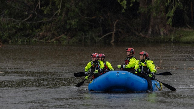
Four people have died in heavy rain and flooding that hit near Chattanooga in Tennessee, officials said.

Gallup has been tracking Americans' drinking behavior since 1939. Here's what a recent survey found.

The CBS News Texas Mornings crew celebrated back to school with its third annual school bus special.

Alaska's capital of Juneau is bracing for what could be record floodwaters due to rainwater and snowmelt flowing downstream from a basin dammed by the Mendenhall Glacier.


Several organizations are accepting donations for those impacted by the floods, as well as first responders and volunteers.
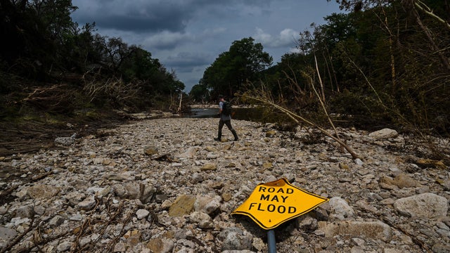
Former campers, who are now adults, share their memories from Camp Mystic and remember those who died in the devastating Hill Country flood on July 4.
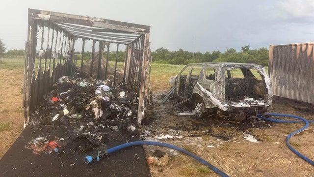
An act of nature has destroyed what was a kind gesture from a group of people in Parker County.

Texas officials have faced questions over their preparedness and the speed of their initial actions when flash flooding hit.
The public hearing will take place at Hill Country Youth Event Center at 9:30 a.m.

FIFA needs more than 6,000 volunteers for the events in the Dallas area.

Cheer stunts, fatherly wisdom, and an unshakable bond — that's what you'll find on Roland Pollard's Instagram feed.
The circumstances surrounding Bevers' death have remained a mystery.
One resident shared that their worried about gentrification and people being forced out of their homes.
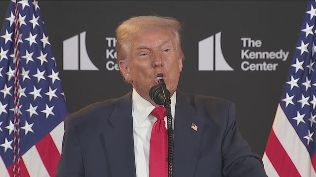
President Trump stated that the White House will seek "long-term extensions" from Congress to maintain control of the D.C. Metropolitan Police Department, part of the president's effort to crack down on crime in the nation's capital.

The new store will employ at least 500 people.
Schottenheimer underwent surgery in 2003 for thyroid cancer at the Mayo Clinic in Rochester, Minnesota.

Video of the scene from CBS News Texas Chopper showed a white Toyota SUV severely damaged with numerous airbags deployed. The other vehicle that appeared to be involved was a heavy-duty pickup truck.
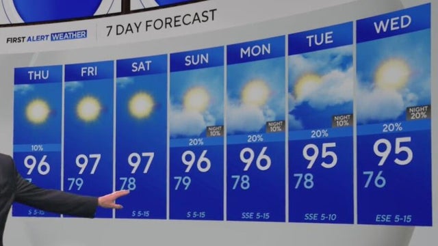
Another round of rain is possible on Wednesday afternoon, with scattered showers and storms expected in some spots.
Not everyone will see a storm, but those that do may get brief downbursts of wind, heavy rain and frequent lightning.
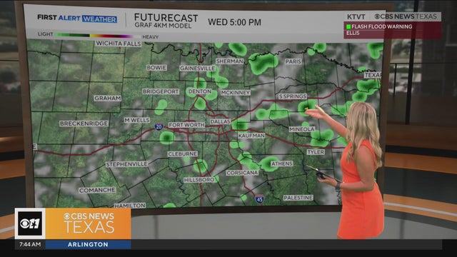
First Alert meteorologist Lauren Bostwick has the latest forecast.
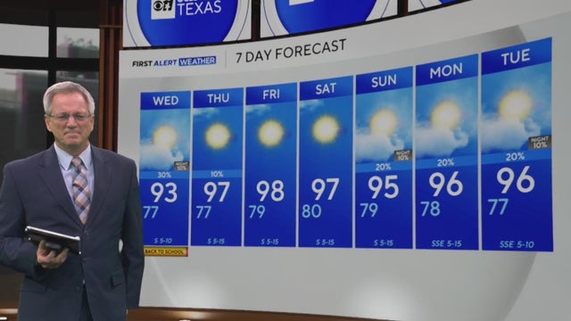
Temperatures are expected to rise into the upper 90s after being below average the last week across DFW.

For migrant children, who range in age from 3 to 17 years old and arrive in the U.S. without a guardian, applying for asylum can be a confusing obstacle.
SB 36 will create a division of Homeland Security within Texas's Department of Public Safety.

Two weeks ago, the Trump administration began carrying out its latest tactic aimed at fast-tracking deportations.

The detentions come on the heels of similar arrests earlier this week in immigration courts across the country.
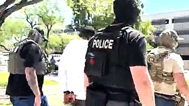
Multiple sources have confirmed that at least a handful of people were arrested on the spot after their cases were dismissed in Dallas.

While illegal migrant crossings have dropped, immigration courts now have a historically high volume of cases

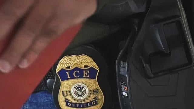
With the expansion of the 287(g) program, local and state officers will be able to enforce some immigration duties.
While the Trump administration says they're only targeting criminals for deportation, those words have done little to comfort some immigrants
A few weeks into his second term, President Donald Trump has issued dozens of executive orders.

The Rangers, held to four hits, led 2-1 after three innings on sacrifice flies by Adolis García and Marcus Semien.

Maddy Siegrist tied a career high with 22 points in her first start since June 6.
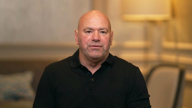
UFC CEO Dana White confirmed plans for a July 4, 2026 fight at the White House to mark America's 250th birthday.

Burger lined a 99.4 mph pitch from Andrew Saalfrank (0-1) off the left-field wall to end the game.
FIFA needs more than 6,000 volunteers for the events in the Dallas area.
Eat See Play: Sponsored by Metroplex Cadillac Dealers

Eat See Play: Sponsored by Metroplex Cadillac Dealers

Eat See Play: Sponsored by Metroplex Cadillac Dealers

Eat See Play: Sponsored by Metroplex Cadillac Dealers

Eat See Play: Sponsored by Metroplex Cadillac Dealers

Eat See Play: Sponsored by Metroplex Cadillac Dealers

Eat See Play: Sponsored by Metroplex Cadillac Dealers

Eat See Play: Sponsored by Metroplex Cadillac Dealers

Eat See Play: Sponsored by Metroplex Cadillac Dealers
Cowboys owner credits experimental immunotherapy for saving his life after Stage 4 melanoma.
When a drug investigation began, police said Keith Kemp pulled out a handgun and threatened to shoot himself.
President Trump said the White House will seek "long-term extensions" from Congress to maintain federal control of the D.C. police as part of a push to crack down on crime.
Responding paramedics took four children and two adults to the hospital after the two-vehicle crash.
Not everyone will see a storm, but those that do may get brief downbursts of wind, heavy rain and frequent lightning.
Even though the project was first proposed 57 years ago, construction hasn't started on the Marvin Nichols Reservoir.
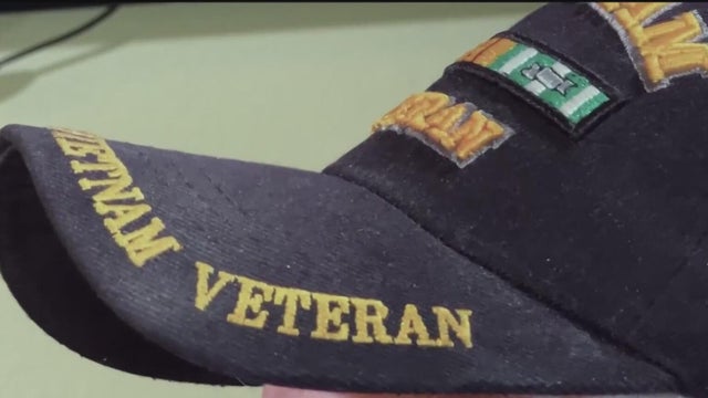
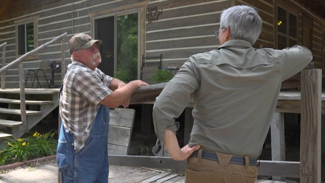
The VA in North Texas is using a new algorithm to calculate the hours of in-home care that veterans receive.

The nonprofit employs men and women who have had past run-ins with the law to work as mentors for at-risk teens and young men.

Sidhartha "Sammy" Mukherjee and his wife Sunita became known for their Bollywood-style performances, became local celebrities, hosting parties and headlining music and cultural events.
On Thursday, the Texas House and Senate announced the creation of committees on disaster preparedness and flooding.
President Trump said the White House will seek "long-term extensions" from Congress to maintain federal control of the D.C. police as part of a push to crack down on crime.
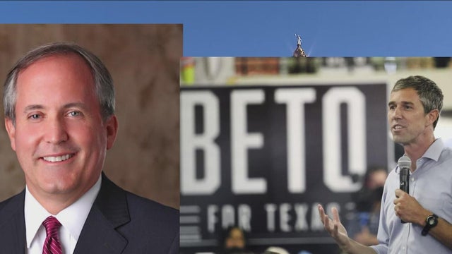
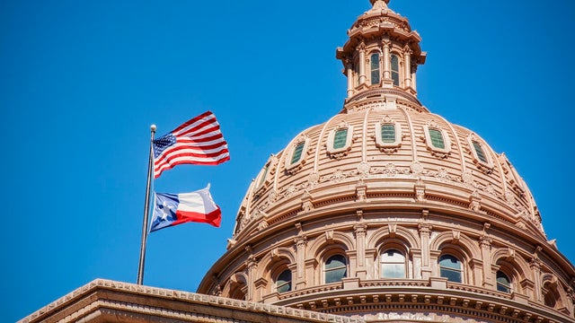
Democrats have refused to give Governor Greg Abbott the seats he wants to give to President Donald Trump.
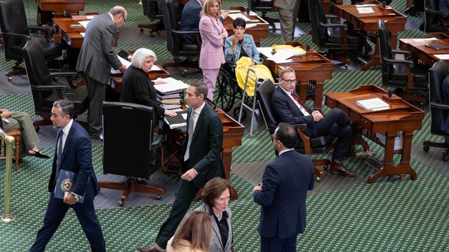
Republican leaders announced that if they can't reach a quorum again at 10 a.m. Friday, Aug. 15, both the House and Senate will wrap up the special session.
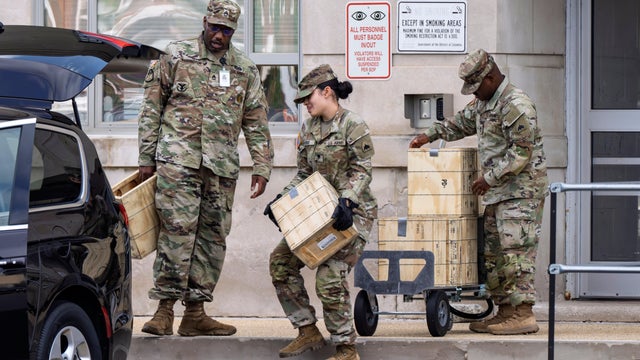
President Trump is calling up the D.C. National Guard and federal law enforcement to address crime in the capital.
E.J. Antoni, an economist nominated by President Trump to lead the Bureau of Labor Statistics, said the jobs report is flawed.

At Fort Worth ISD's North Side High School, the sounds of an American sport on the field meet mariachi music in the stands.

With new foods, such as the "Drowning Taquitos" and the "Beso de Angel," Tony's Taco Shop owners say they don't take their success for granted.

Latinas in Tech DFW started back up last year after the pandemic. They have lots of opportunities for Latinas to network, connect, and learn new skills.
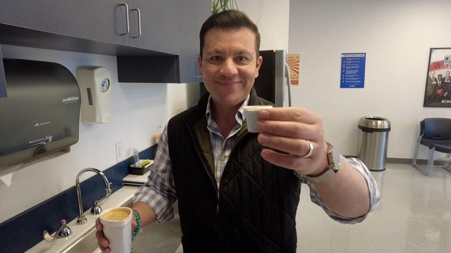
Anchor Ken Molestina shows us how he makes his Cuban coffee for the CBS News Texas newsroom.
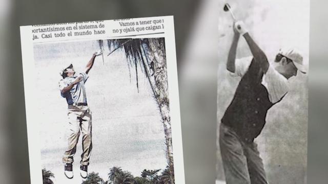
Del Olmo, who has played golf his entire life, recalls how rare the sport was for people like him growing up in Mexico City.

Less than two days after Delta Air Lines offered $30,000 to each passenger on board the flight that crashed and flipped in Toronto on Monday afternoon, the company is facing its first two lawsuits in the incident — and they likely won't be the last.

Texas Agricultural Commissioner Sid Miller is calling for a statewide ban on non-water additives, such as fluoride, in the public water system.
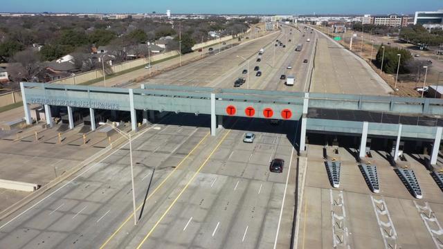
Last year, over 16 million vehicles drove on North Texas toll roads without paying, accumulating more than $69 million in unpaid tolls.

Activists are calling for a nationwide boycott of Target stores following the company's decision to roll back its diversity, equity and inclusion initiatives.

Discount store chain Target says it's joining rival Walmart and a number of other prominent American brands in scaling back corporate diversity, equity and inclusion initiatives.

Instagram rolled out a new Map feature that lets users see their friends' locations in real time. Here's why privacy experts are concerned.
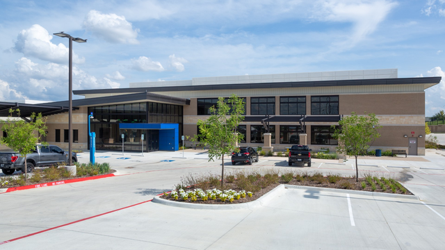
For the first time in more than 30 years, a Fort Worth community long considered a "health care desert" now has nearby access to basic medical care.
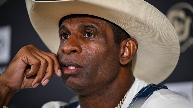
Head Colorado Buffaloes football Coach Deion "Coach Prime" Sanders revealed his bladder cancer diagnosis for the first time on Monday morning.

Pepsi hops on another nutritional bandwagon as more consumers opt for prebiotic beverages.

Many Southeast, Southern and West Coast states are likely seeing an increase in COVID cases.

A truck had smashed through the front of Bruno's Place, destroying much of the inside.
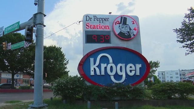
Kroger said it intentionally decreased prices, but some customers said the financial drop at the register went in a different direction.
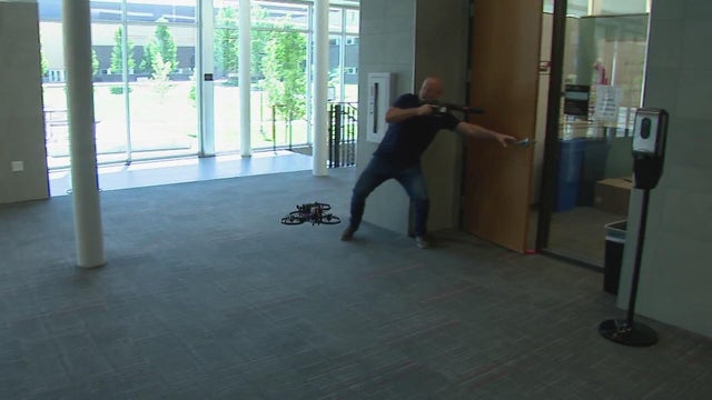
Could the solution to school shootings be drone first responders? An Austin-based tech company thinks so and is testing them at a private high school in Aurora.

Located off the Guadalupe River in Historic Old Ingram Loop, the shop was once filled floor to with lighting, decor and trinkets.

They were already concerned about tariffs, but construction businesses in North Texas said they have new fears with the president's immigration crackdown.
The Rangers, held to four hits, led 2-1 after three innings on sacrifice flies by Adolis García and Marcus Semien.
Maddy Siegrist tied a career high with 22 points in her first start since June 6.
UFC CEO Dana White confirmed plans for a July 4, 2026 fight at the White House to mark America's 250th birthday.
Burger lined a 99.4 mph pitch from Andrew Saalfrank (0-1) off the left-field wall to end the game.
FIFA needs more than 6,000 volunteers for the events in the Dallas area.

Known for her role as Dee Thomas on the 1970s sitcom "What's Happening," Danielle Spencer has died at the age of 60.
UFC CEO Dana White confirmed plans for a July 4, 2026 fight at the White House to mark America's 250th birthday.

Taylor Swift announced her 12th studio album, "The Life of a Showgirl," after a countdown tease on her website. She didn't say when it would be released.

Prince Harry and his wife, Meghan, announced Monday that their media company's partnership with Netflix has been extended with a multiyear, first-look deal.

Paramount will become the new home to all UFC events in the U.S., while UFC's CEO says the White House may host a July 4 event broadcast on CBS.
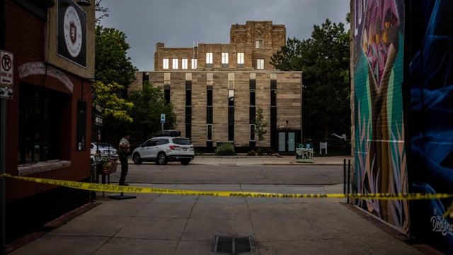
A suspect was taken into custody after an attack on Pearl Street Mall in Boulder on June 1 in which there were 15 people and a dog who were victims. The suspect threw Molotov cocktails that burned some of the victims, who were part of a march for Israeli hostages.

The Neonatal Intensive Care Unit babies at Texas Health locations across North Texas celebrated Valentine's Day.

As Anthony Davis prepared for his debut game at the AAC, Dallas Mavericks fans took to the arena to protest the controversial trade.

A look back at the esteemed personalities who've left us this year, who'd touched us with their innovation, creativity and humanity.

CBS News Texas viewers got out and enjoyed the snow day on Thursday and send us all of their best photos. Take a look.